Visible Area
The Areas used in the system are derived from grouping together Postal Areas into Regions and Country. There are 3 ways in which you can change the visible area of the map.
- Click on the map
-
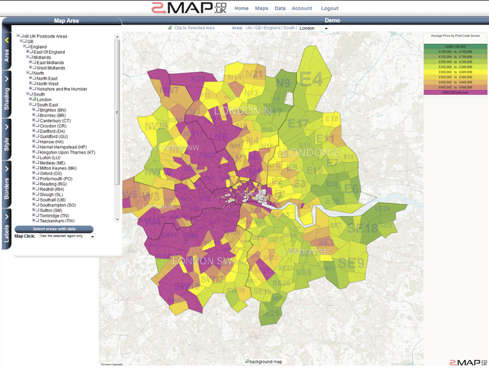
If you click on an area inside the current selected area - then that child becomes the new selected area (the map zooms in).
If you click on an area outside the selected area then that sibling area becomes the selected area (the zoom level remains the same).
- Use the 'Area Path' tool.
-
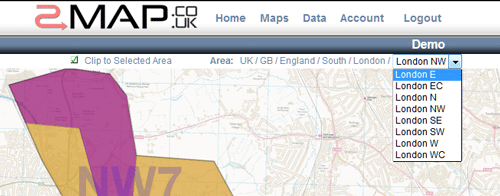
The 'Area Path' tool is located above the map and below the banner. It shows the current selected area and its ancestors (region, country etc).
If you click on an ancestor such as 'England' then 'England' becomes the new selected area.
If you click on the dropdown menu on the right of the area path then you can choose a new sibling of the current selected area (for example you quickly switch from London SW to London NW.
To select a new child region either click on the map as described above or use the 'Area Tree' as described in the next section.
- Use the 'Area Tree' tool.
-
The 'Area Tree' tool is opened by clicking on the 'Area' tab control. You can use it to select multiple areas to be shown at once.
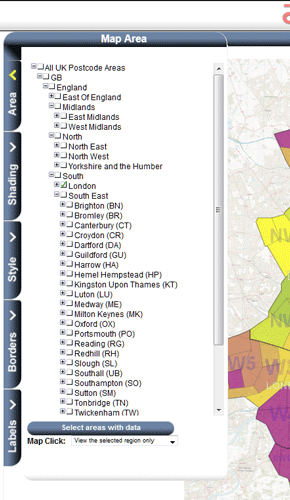
To add an area simply select the checkbox next to it in the tree. Unchecking it removes it from the selection. By selecting a country it will automatically deselect any areas below that level (because they are within the selected area).
If you are viewing a dataset which only has data for a few areas within the country - then you may wish to set the viewing area to just those areas that have data. You can do this by clicking the 'Select areas with data' button which is located below the 'Area Tree'.
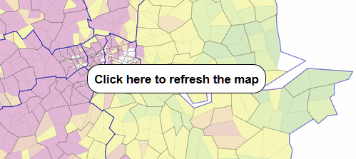
Once you have finished click the 'Update Map' button (which will appear in the center of the map).