Uploading
To get the most out of this site, you need to upload your own data.
- Go to the 'Upload' page
-
Click on 'Data' in the main menu then 'Upload new Dataset' in the submenu that appears below it.
Alternatively you can use the wizard - and select 'New Dataset - upload' from the dataset dropdown.
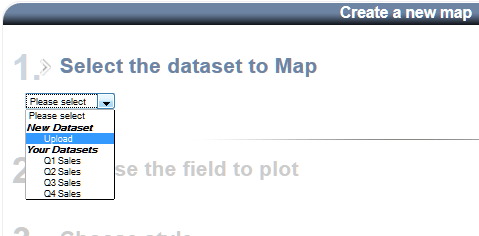
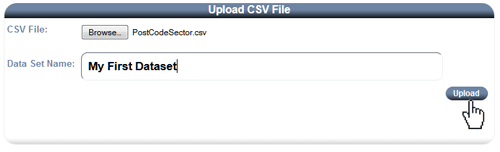
- Select the file to upload
-
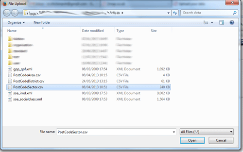
Click on the 'Browse' button
Locate and then select the file on your computer and click 'Open'
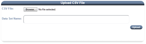
- Enter a name for the dataset
-
Then click 'Upload'
- Data processing
-
If the upload is successful then the system will detect the level/granularity of the data.
If the data contains full postcodes then you will be taken to an extra stage of the map creation wizard (See aggregation). You will be required to aggregate the data by selecting a level to plot it at Postal Area, District or Sector.
Aggregation means that the system will create a new dataset for you at a higher level; by adding up the values for all the postcodes within each area.
- Select the field to plot and default style.
-
If the data is aggregated (at Area, District or Sector level) then you will be taken to the last steps of the map creation wizard.
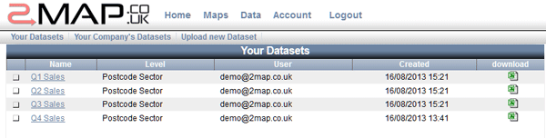
You will see the name of your dataset and the level of data it contains.
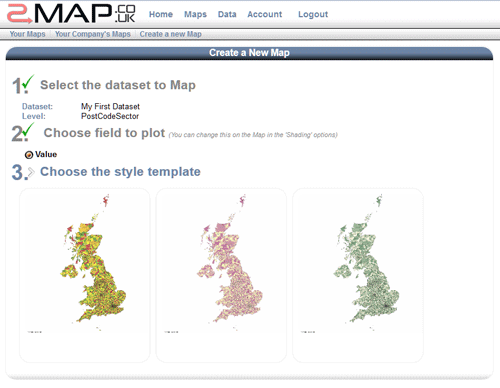
If there are multiple columns/fields in your dataset then you will need to select which one to plot.
Once the field is chosen you can select the default style for the map.
- Customise and Browse your Map
-
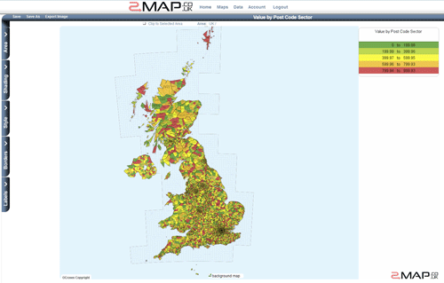
Now why not look at the 'Quick Start Guide' or the 'Map Screen' pages to see what you can do with the map of your data.